

3s Group

3SGroup (formally known as Mapyx) is the market leader in the provision of fully integrated mapping, search management and tracking solutions. They are highly trusted partners of many highly recognisable and reputable organisations such as the Police, Government, Military, Search & Rescue, HM Coastguard and hundreds of schools and activity providers across the country. All of the above, along with a number of existing DofE groups use 3S Group tracking and could not recommend it highly enough.
Specialising in providing GIS solutions for education, personal and professional users, 3S Group enable schools and organisations to feel reassured and know their DofE groups are safe while they carry out their challenge.
Why Choose 3s Group?
The 3S Group suite of solutions is unique. It is used by the Emergency Services and other professionals to protect and save lives. The team themselves have been involved in search management and tracking for decades. Their spare time is actually taken up by an active involvement in Mountain and Lowland Rescue.
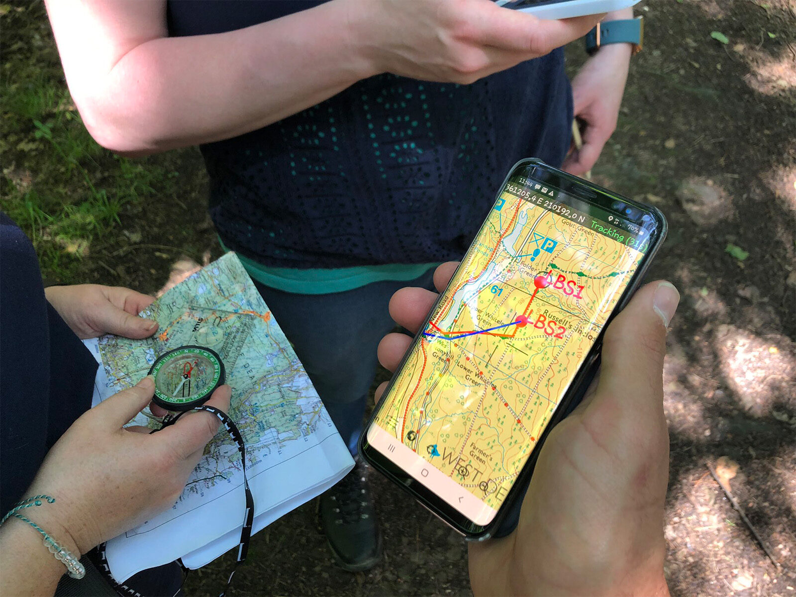
- Simple and easy to use user interface across mobile, SMS, PC and web
- You can track multiple groups in multiple locations
- Remote supervision to support the in person supervision from Leaders actually allows greater autonomy for participants on their expedition
- Offers unbeatable value-for-money with competitively priced, high-quality products. Tracker charges are fully flexible, reducing costs of entry and use
- 24/7 monitoring to ensure DofE groups can be pinpointed to their exact location at all points of their expedition journey and contact with emergency support can be made instantly if required. This cuts out the uncertainty and delay in getting to groups who are in danger or at risk
- Extensive experience in dealing with serious incidents and responding to them quickly
Examples of Use with DofE Groups:
- Once monitored a group who went off course by almost 2km, being monitored all the way, but realising their mistake, properly navigated back onto the correct route. No intervention necessary and a hand-clap on getting back on course by themselves. Of course, had the traditional checkpoints been used, then not having seen the group, would have led to the leaders scurrying around looking for them. In this case, there was no concern, just careful monitoring.
- Another example was a Gold practice group navigating the Devon footpaths before they hit Dartmoor, and incorrectly entering the wrong field, looking for a non-existent exit, before finally after a couple of laps of the field, getting back on track by themselves. In both cases no intervention was necessary, but each time the group were being monitored. The Devon group came back asking to be shown where they had gone wrong and that was easily remedied by showing the track of their movements.
If you are interested in finding out how to enhance the experience, education and safety of all involved in your expeditions, please hit the button below to request a call back.
You will receive a no obligation quotation from 3S Group. You can also contact them on 01392 241428 or by email to [email protected]